Terrain
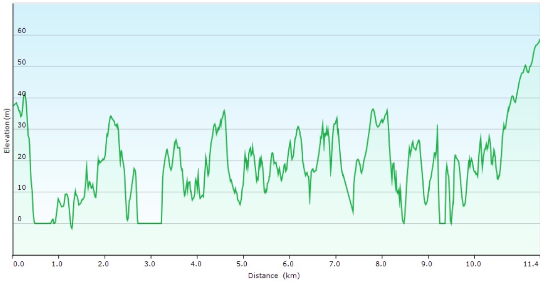
UndulatingPark(s)
Bradfield Park, Henry Lawson Reserve, Blues Point Reserve, Sawmillers Reserve, Waverton Park, Balls Head Reserve, Oyster Cove Reserve, Badangi Reserve, Berry Island Reserve, Gore Cove Reserve, Smoothey ParkArea
North ShoreTravel Options
1. Train2. Car (Parking Blight St, Milsons Point, Milner Crescent, Wollstonecraft)
Travel Time from Central Sydney
10-20 mins (by car)About the Walking Track
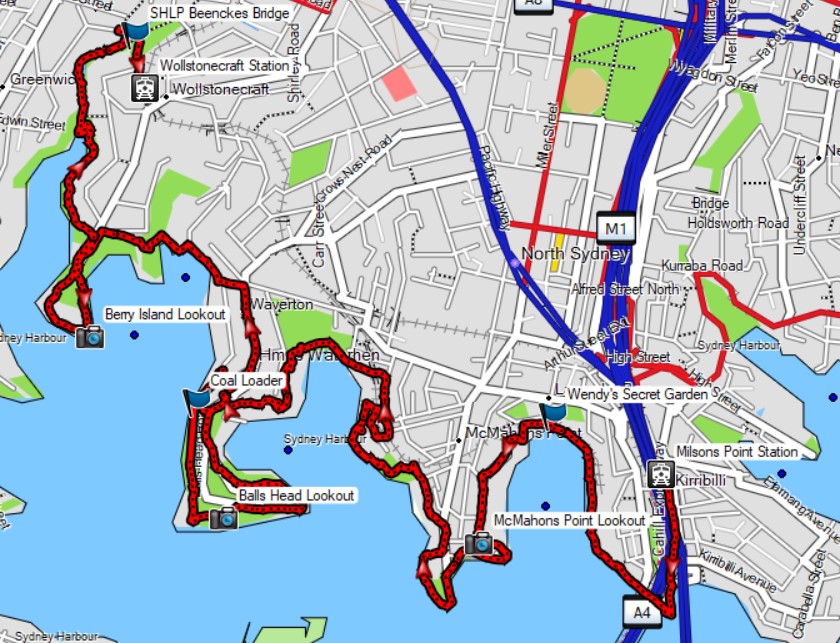
This walk has it all and is Sydney in a nutshell (though without the beaches) including Aboriginal history, Wendy Whiteleys Secret Garden, the historic Coal Loader, spectacular headland harbour views and Sydney's beautiful angophora forests. Station to station a very accessible way to see the harbour, a short ride from the city.
From Milsons Point to Berry Creek, this route runs along paths through a series of local parks beside the harbour connected by short sections of street walking. At Berry Creek, it follows a track beside the creek up to Wollstonecraft Station.
Public Transport
T1 train from Central to Milsons Point Station. The walk starts on the eastern side of this station. Return by T1 train from Wollstonecraft Station. A trip planner is available from Transport NSW web site.


