Distance
6.4 kilometres circuitDuration
2-3hrs excluding breaksSuitable for
Walking/JoggingTrail Grade
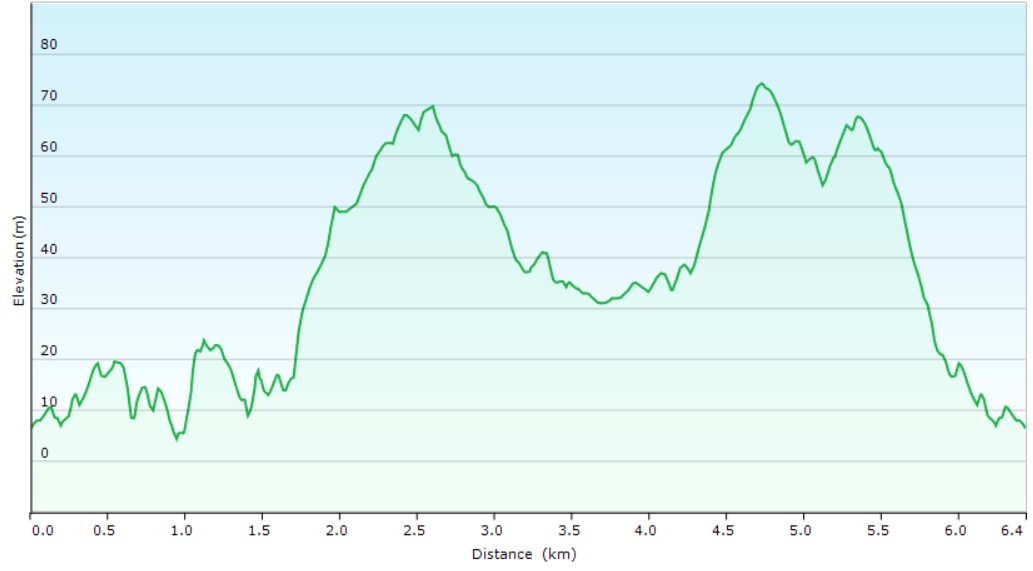
Grade 2Terrain
UndulatingPark(s)
Grant Reserve, Trenerry Reserve, South Coogee Wetlands, Gollan Park, Latham Park, Randwick Environment Park, Emily McCarthy Park, Blenheim ParkArea
Eastern SuburbsTravel Options
1. Light Rail & Bus2. Car (Coogee Bay Village, Coogee Bay Oval-fee)
Travel Time from Central Sydney
20-40 minutes (by car)About the Walking Track
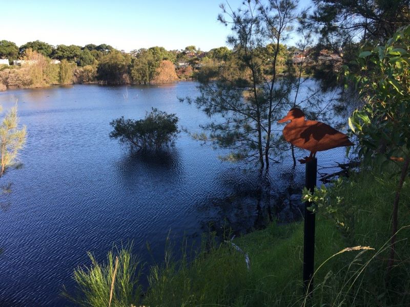
This circuit on Cadigal and Bidjigal land has spectacular ocean panoramas and hanging swamps along the coast while the wetlands at Randwick Environment Park provide a wonderful contrast.
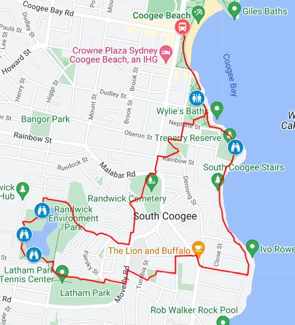
Follow the Coast Walk from Coogee Beach to Cuzco Street then uphill to Malabar Road. Head north to the pedestrian crossing at Nymboida Street. Follow this street to Gregory Street, Phillip Street, Gollan Park, Macleay Street and Moverly Road to Asturia Avenue. Enter Latham Reserve just before the bend. Walk westwards to the end of the reserve and enter Randwick Environment Park at Argyle Crescent. Follow the path west and north around the wetlands in Randwick Environment Park and past the permaculture garden before heading east past the oval cycle track to steps and laneways up to Moverly Road. Turn left to Elphinstone Road, Emily McCarthy Park and Randwick Cemetery. On the northern side of the cemetery cross Malabar Road to Arden Street and Rainbow Street, arriving at Blenheim Park overlooking Coogee and the coastline. Walk down to Beach Street and Grant Reserve and back along the Coastal Walk to Coogee Beach.
Public Transport
L3 Light Rail from Chalmers Street, Central to Randwick LR Station. 373 bus to Arden Street at Coogee Bay Road. The walk starts opposite this stop. A trip planner is available from Transport NSW web site.


