
Distance
7.1 kilometers one way
Duration
3 hrs excluding breaks
Suitable for
Walking/Jogging
Trail Grade
Grade 3
Terrain
Hilly
Park(s)
Blue Mountains National Park
Area
Blue Mountains

Travel Options
1. Train2. Car (Winbourne Rd, Hazelbrook; Railway Parade, Hazelbrook)

Travel Time from Central Sydney
1¼-2 Hours (by car)
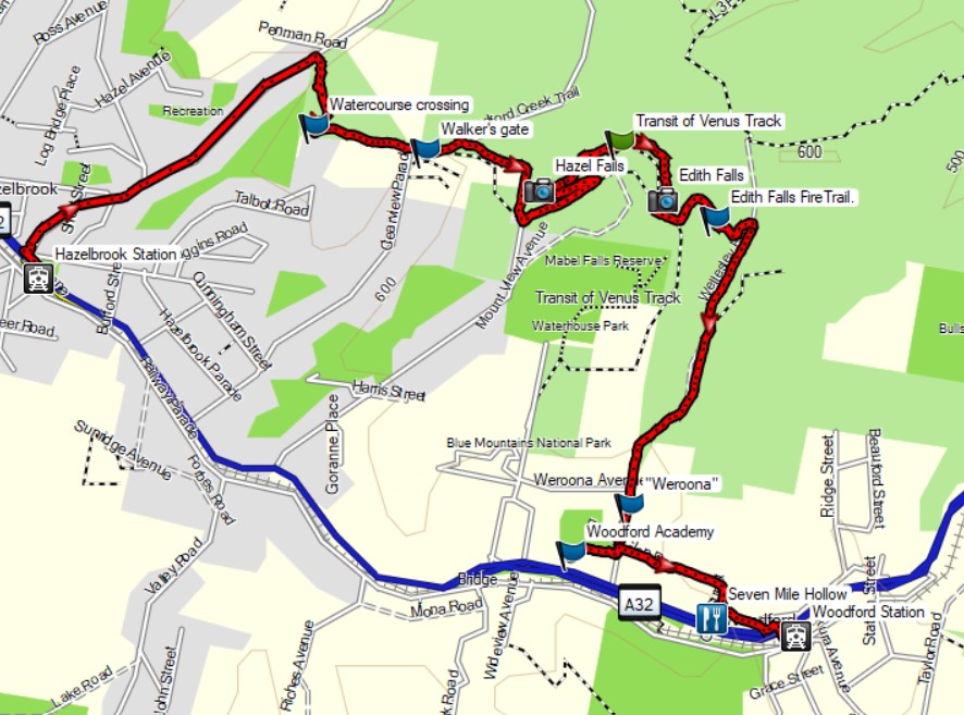
Map

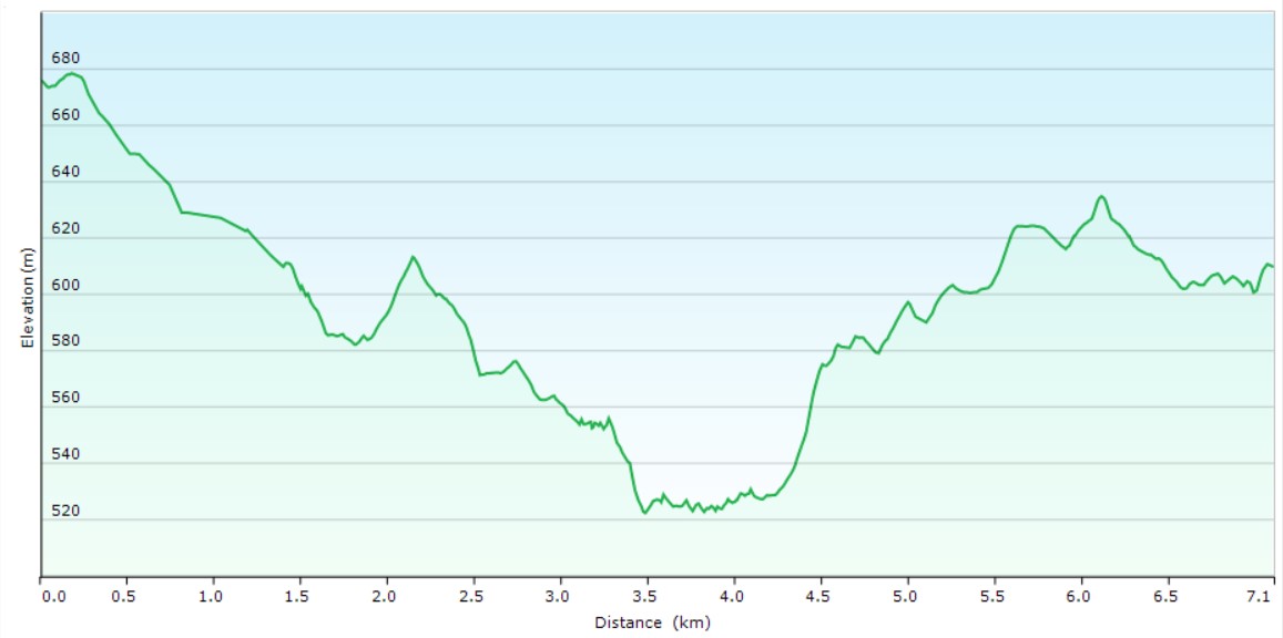
Ascent/Descent
About the Walking Track
Walk down Winbourne Road from Hazelbrook Station to a foot track on the right GPS65041 66405 at the end of this road. Follow this track down to a watercourse then up a powerline track to Clearview Parade. Walk through the walker’s a gate onto the L5 Fire Trail and follow this and the L4 Trail to the Transit of Venus Track GPS 66013 65981. Turn left and follow this foot track past Hazel Falls and Edith Falls to re-join the L4 Trail up to the L3 trail. Turn right to the Woodford Academy then left down Forest Glen Road and a short scramble to Glen Street, Vautin Lane and the footbridge over the highway to Woodford Station.
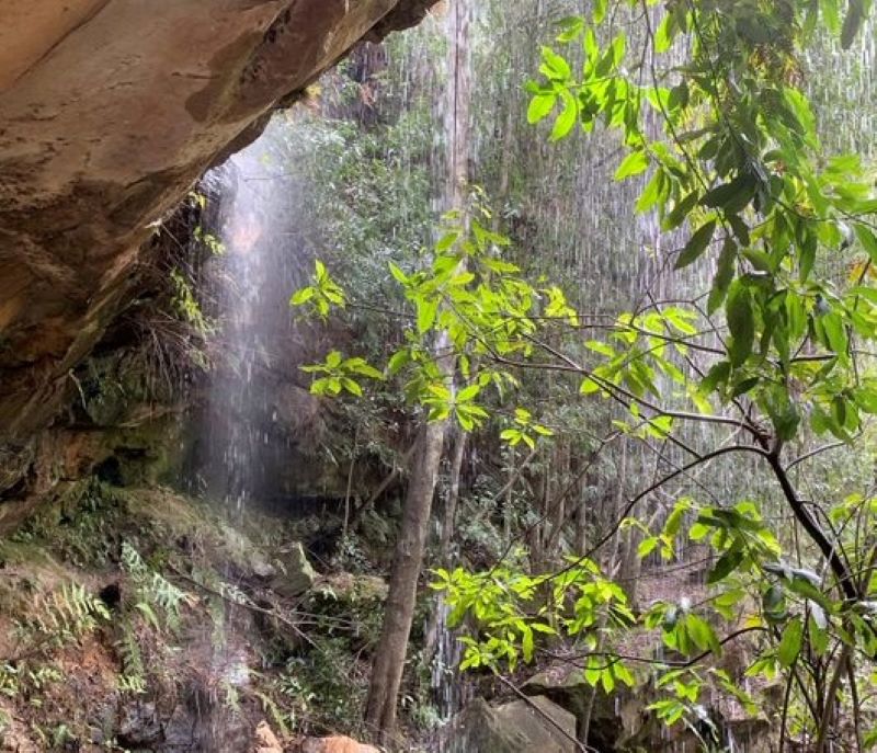
This walk is unexpectedly beautiful with views across Woodford Creek to the ridges beyond while the rainforest at Hazel Falls and Edith Falls provides a wonderful contrast to the eucalyptus forests and sandstone ridges. “Weeroona” and Woodford Academy remind you of the fascinating history of the Mid-Mountains.
Public Transport
Blue Mountains train from Central to Hazelbrook Station. The walk starts at this station. Return by same train from Woodford Station. A trip planner is available from Transport NSW web site.