

Distance
6.6 kilometres one way
Duration
2hrs 15mins excluding breaks
Suitable for
Walking/Jogging
Trail Grade
Grade 2
Terrain
Flat but some steps
Park(s)
Blackmore Oval, Murden Reserve, Cadigal Reserve, Johnson Park, Laxton Reserve, Shanahan Reserve
Area
Cooks River

Travel Options
1. Light Rail/Train2. Car (James St, Lilyfield; Keith St, Dulwich Hill)

Travel Time from Central Sydney
12-30 mins (by car)
Map


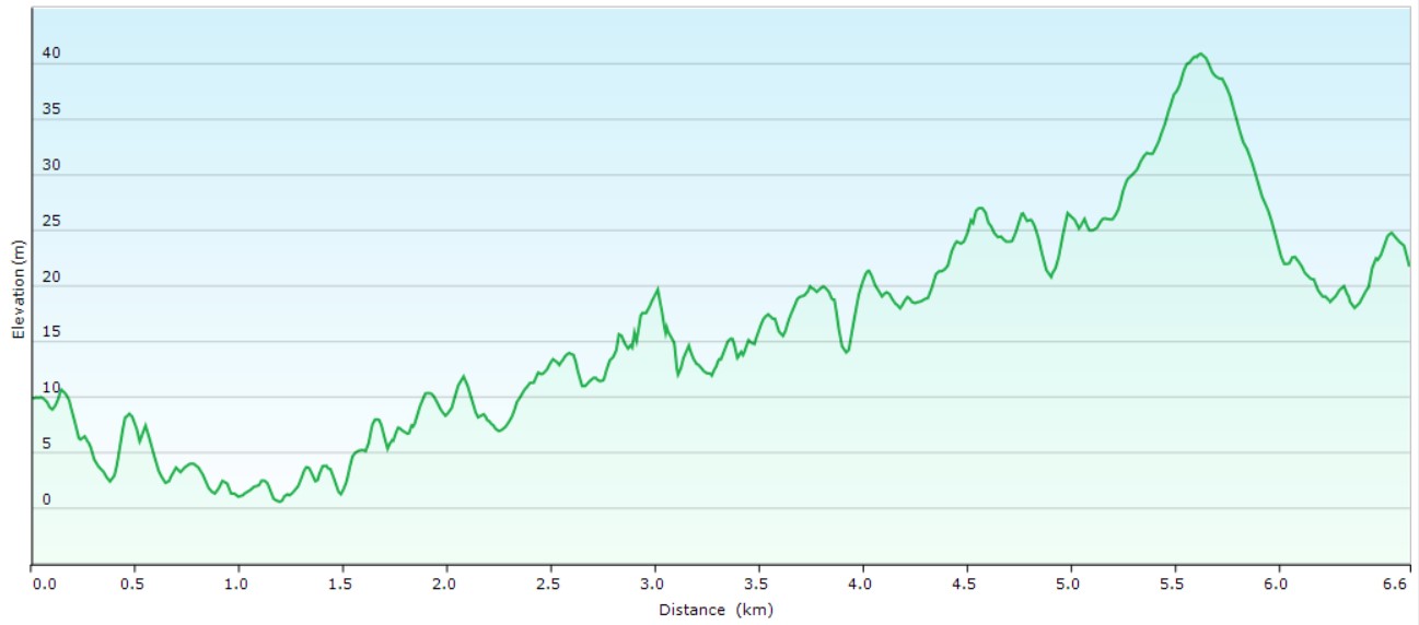
Ascent/Descent
About the Walking Track
The Greenway features shared paths, foreshore walks, cultural and historical sites, cafes, bushcare sites and a range of parks, playgrounds and sporting facilities. It will eventually follow the route of Hawthorne Canal and the Inner West Light Rail Line from Iron Cove to Cooks River.
From North Leichardt Light Rail stop, head west to Blackmore Oval and the footbridge over Hawthorne Canal. Head south on the Greenway beside the canal across Marion Street and Parramatta Road to Grosvenor Crescent, crossing the first two via traffic lights and a pedestrian overbridge. A short street walk to Harvest Park and across the Light Rail to Hudson Street Park. Along Old Canterbury Road to Weston Street. At its end a laneway takes you to Davis Street and a path through the Waratah Mills residential complex to Terry Road, Windsor Road and Johnson Park. Through this green oasis, past Arlington Oval to Laxton Reserve. Along Union Street to Canterbury Road and on via Myra Road, the Parade and Terrace Road to Shanahan Reserve and Dulwich Hill Light Rail terminus or Dulwich Hill Station.
Public Transport
L1 Light Rail from Central Station to Leichardt North stop. The walk starts at this stop. Return by L1 Light Rail from Dulwich Hill LR stop or T3 train from Dulwich Hill Station to Central. A trip planner is available from Transport NSW web site.