
Distance
9.9 kilometres one way
Duration
3 ½ - 5 hrs excluding breaks
Suitable for
Walking/ Jogging
Trail Grade
Grade 2
Terrain
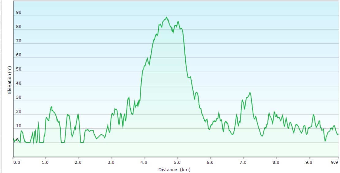
Undulating
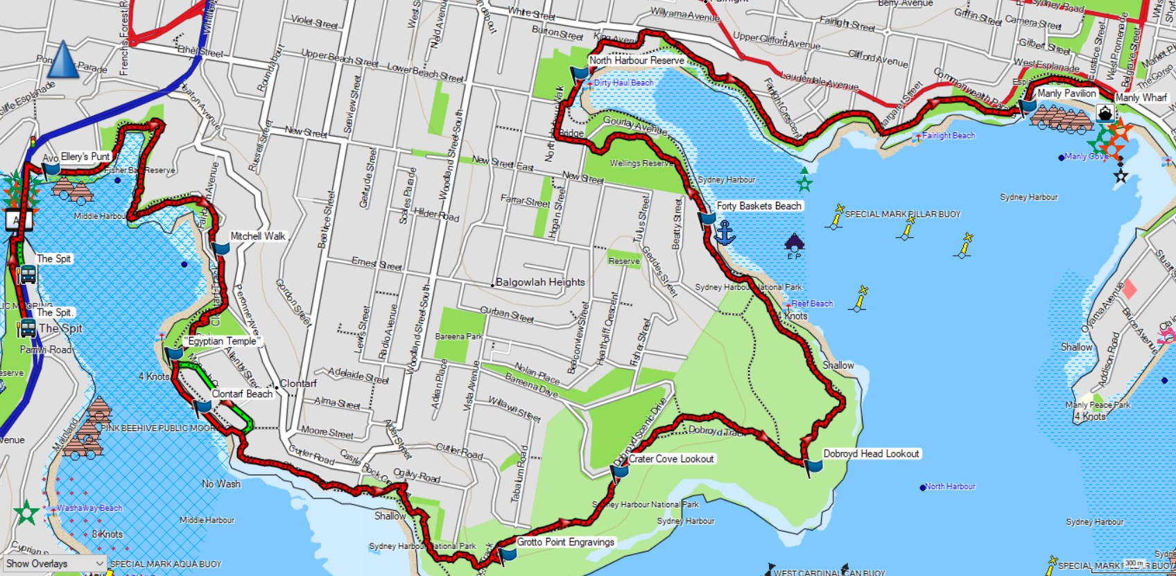
Park(s)
The Spit Reserve, Ellerys Punt Reserve, Fisher Bay Reserve, Clontarf Reserve, Sydney Harbour National Park, Wellings Reserve, North Harbour Reserve, Esplanade Park, West Esplanade Park
Area
Northern Beaches

Travel Options
1. Bus and Ferry2. Car (Spit West carpark; Whistler carpark, Manly)

Travel Time from Central Sydney
20-45mins (by car)
Map

Ascent/Descent
About the Walking Track
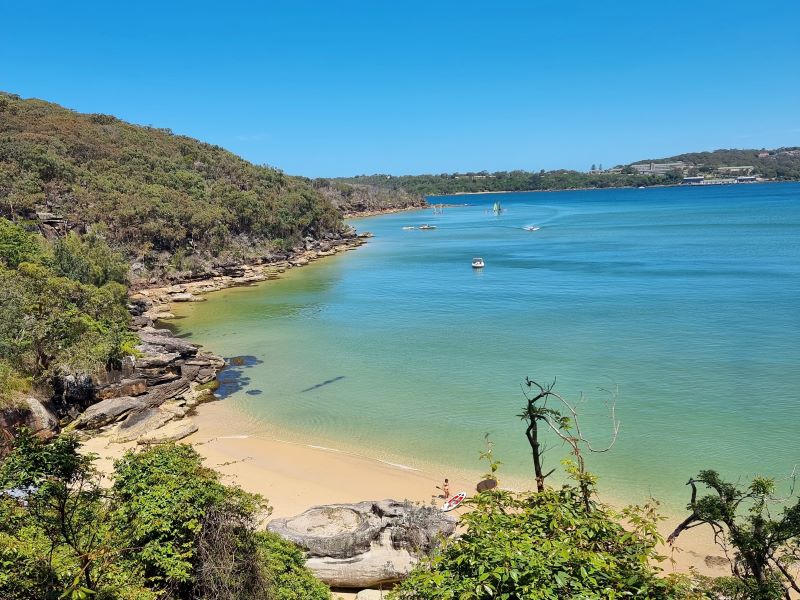
This iconic walk along Middle Harbour and North Harbour is easily accessible by public transport. The walk is relatively easy but does have some steeper sections with steps and handrails to make it safer. Most people take 3-5 hours but you could easily spend a full day enjoying the secluded beaches, forests, coastal heath and magnificent vistas of Sydney Harbour.
From the bus stop at Spit West, walk north to the Spit Bridge before crossing to its northern side. Drop down to the harbourside track and follow Fisher Bay Walk to Sandy Bay. Cross Sandy Bay Road to Mitchell Walk over to Clontarf Reserve. Depending on the tide, walk along the beach or Monash Crescent to its eastern end and then take the Clontarf and Castle Rock Tracks to Grotto Point Engravings and Crater Cove Lookout. Continue on the track to Dobroyd Head, Reef Beach, Seven Baskets Beach and Wellings Reserve. Cross North Harbour Creek footbridge and head north to North Harbour Reserve and a short street walk to the North Harbour Walk to Manly Pavilion, Manly Cove Beach and Manly Wharf.
Public Transport
T1 train from Central to Wynyard and 173X bus from Stand A in Carrington Street to stop 208811 at Spit West Reserve, Spit Road. The walk starts at this bus stop. Return by F1 ferry from Manly Wharf to Circular Quay and T2, T3 or T8 train to Central. You can also take the F1 ferry to Manly and the 144 bus from Stand G in Belgrave Street to The Spit. A trip planner is available from Transport NSW web site. (https://transportnsw.info/trip)