


Terrain
Undulating
Park(s)
Oatley Park
Area
Georges River

Travel Options
1. Train/Bus2. Car (Douglas Haig Street)

Travel Time from Central Sydney
½ -1 hour (by car)
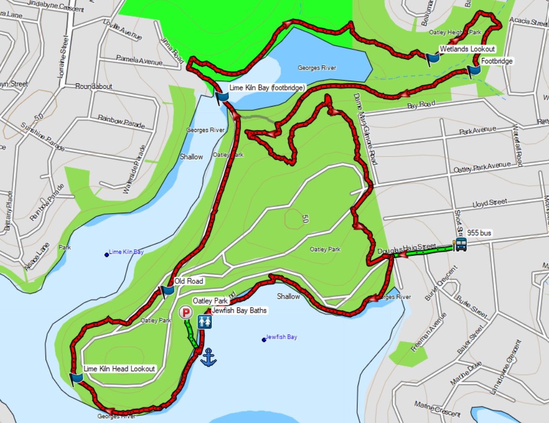
Map

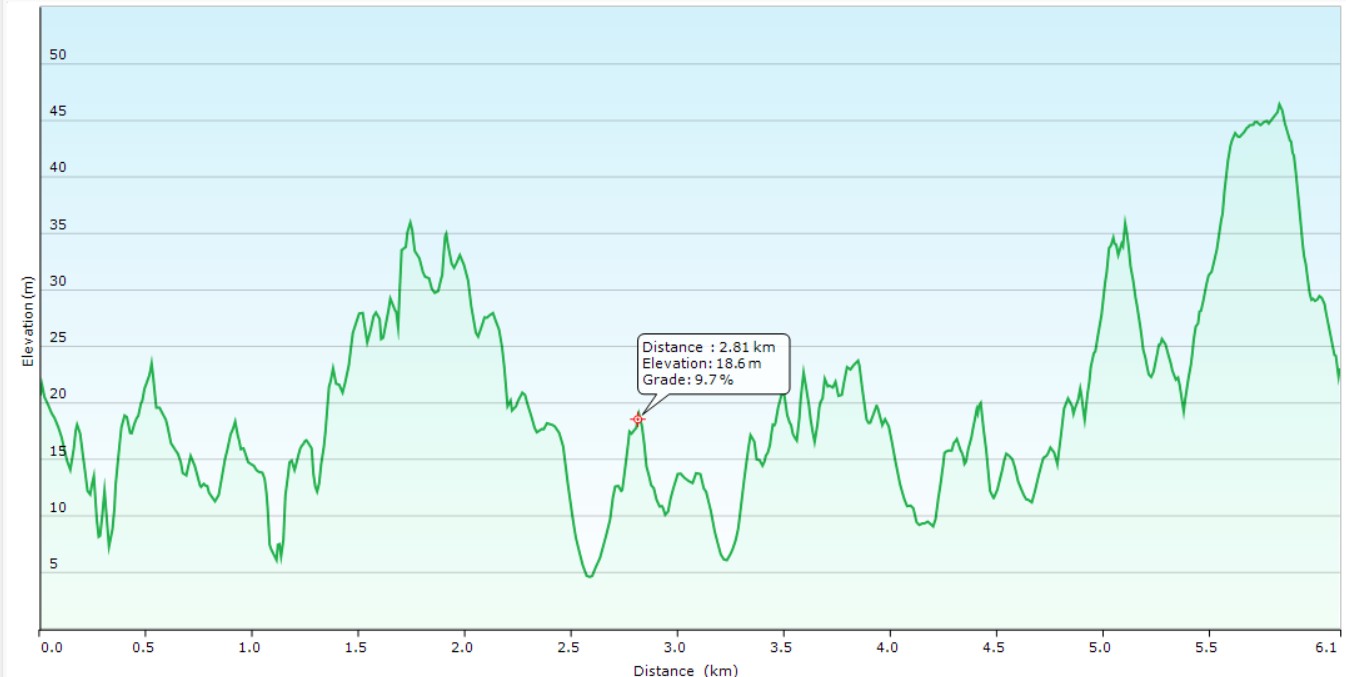
Ascent/Descent
About the Walking Track
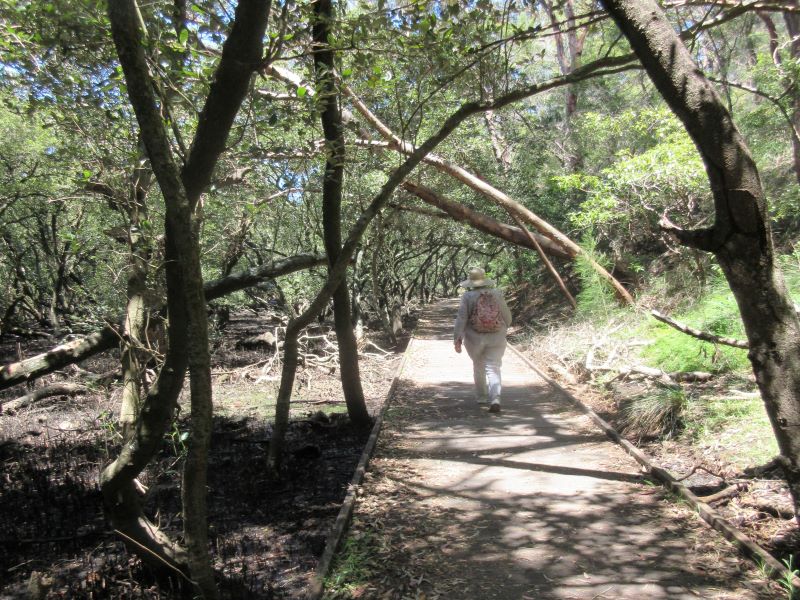
This circuit walk through one of the best areas of remnant bushland in the St George region offers a variety of terrain and flora. You will be rewarded with countless views of Jewfish Bay, Georges River and Lime Kiln Bay. Enjoy the sandstone outcrops and the incredible man-made wetlands while lookouts on Lime Kiln Head and Lime Kiln Wetlands add to the enjoyment. It can be walked in either direction and joined at a number of points depending on your transport (Douglas Haig Street by bus, Jewfish Bay carpark by car).
The path starts at the Douglas Haig Street entrance and heads west via the baths in Jewfish Bay to continue west around Lime Kiln Point to a disused bitumen road running down to Frog Hollow. Cross Lime Kiln Bay and head east past the golf course then along the track on the northern side of the wetlands before returning on its southern side to a track up to the Oatley Park Avenue entrance and another track down to Douglas Haig Street.”
Public Transport
T4 train from Central to Oatley Station and 955 bus from Oatley Station to stop 2223236 in Short Street at Douglas Haig Street, Oatley. The start of the walk is 200 metres west along Douglas Haig Street. Return by same bus and train. A trip planner is available from Transport NSW web site.