

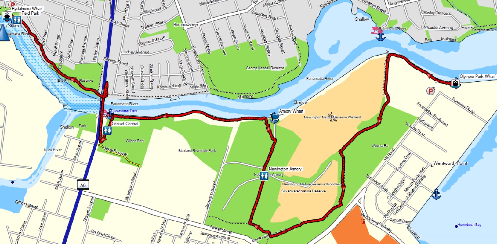
Distance
6.7km one way
Duration
2hrs 20mins excluding breaks
Suitable for
Walking/Jogging
Trail Grade
Grade 2
Terrain
Flat
Park(s)
Newington Nature Reserve, Blaxland Riverside Park, Wilson Park, Eric Primose Reserve, Reid Park
Area
South of Harbour

Travel Options
1. Ferry2. Car (Lapwing Street, Wentworth Point, John Street, Rydalmere)

Travel Time from Central Sydney
30-50 mins (by car)
Map

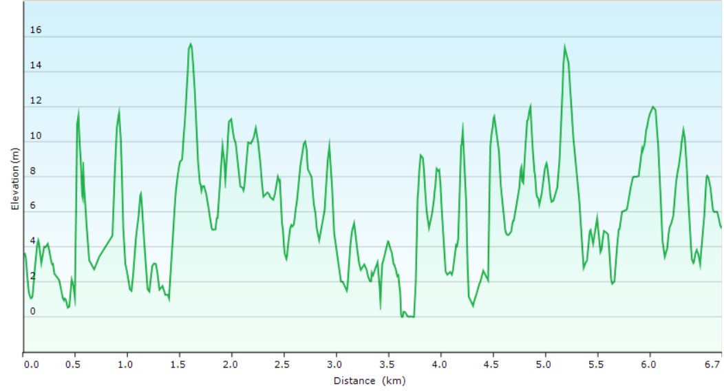
Ascent/Descent
About the Walking Track
From Olympic Park Wharf, head west along the river path to Louise Sauvage Path. Head south on this path past occasional ammunition bunkers and a narrow gauge railway to The Armory (gateway open sunrise to 5pm). Turn left and cross the railway to the main path where you turn right to the main gates at the Parramatta River Armory Wharf. Turn left (west) along the river path almost to Silverwater Bridge. Turn left past Cricket Central to Clyde Street and the eastern pathway of this bridge. On the northern side of the bridge take the path back to the river and turn right under the bridge on the pathway to Rydalmere Wharf.
This walk features pleasant bushland, parkland, riverside walking and the large grasslands of the historic RAN Armory (1897-1999) with its 100 buildings and bunkers, a complex narrow gauge railway system, theatre, gallery, studios, disc golf course, and Birdlife Centre. The Armory Wharf/Blaxland Park area has a restaurant with large playgrounds nearby. The massive Cricket Central complex has indoor nets, classic oval and café.
Public Transport
T1 train from Central Station to Circular Quay Station and F3 ferry from Wharf 5 to Sydney Olympic Park Wharf. The walk starts at this wharf. Return by same ferry from Rydalmere Wharf and same train. A trip planner is available from Transport NSW web site.