
Distance
9.9 kilometres one way
Duration
3hr 30mins
Suitable for
Walking / Hiking
Trail Grade
Grade 3
Terrain
Hilly
Park(s)
Garigal National Park, Davidson Park
Area
North Shore

Travel Options
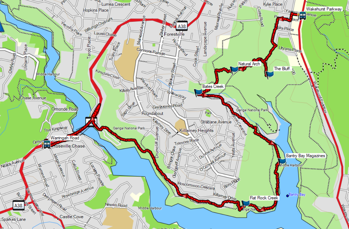
Bus, Car (Penrose Place, Frenchs Forest; Davidson Park, Forestville
Travel Time from Central Sydney
½ -1 hour (by car)
Map

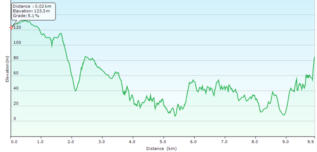
Ascent/Descent
About the Walking Track
A short walk runs to The Bluff where you retrace your steps to follow the Natural Arch Track and Magazine Track down the western side of Bantry Bay past the old Explosives Depot to Flat Rock Creek. The track then contours above Middle Harbour to Roseville Bridge.
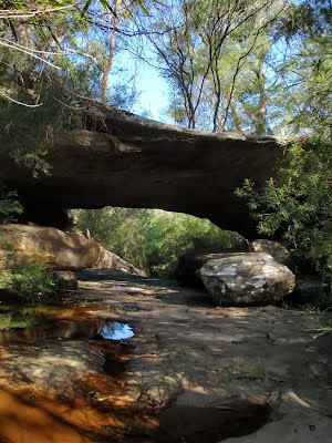
This walk is a succession of stunning harbour scenery from the Bluff with its sensational views down Bantry Bay to Middle Harbour to Flat Rock Cascades and the glorious views across Middle Harbour to Castle Cove. Along the way you will admire the Natural Arch and the old Explosives Depot with its beautiful sandstone magazines.
Public Transport
F1 or MFF ferry to Manly. 271 bus from Stand F in Belgrave Street, Manly to stop 208630 in Wakehurst Parkway at the Yarraman Avenue walkway. Return by 270 0r 271 bus from stop 206968 in Warringah Road before Babbage Road. A trip planner is available from Transport NSW web site.