
Distance
8.1 kilometers circuit
Duration
3 hrs excluding breaks
Suitable for
Walking/Jogging
Trail Grade
Grade 3
Terrain
Undulating
Park(s)
Manly-Warringah War Memorial Park
Area
Northern Beaches

Travel Options
1. Train/Bus2. Car ( Manly-Warringah War Memorial Park)

Travel Time from Central Sydney
1/2- 1 hour (by car)
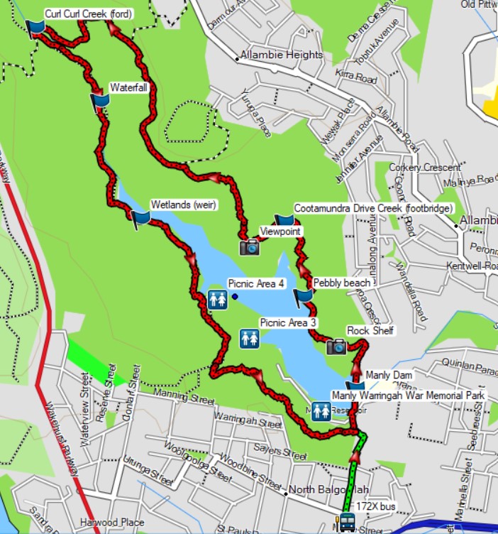
Map

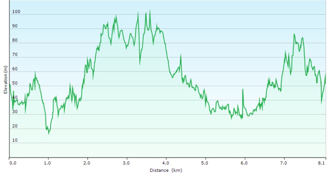
Ascent/Descent
About the Walking Track
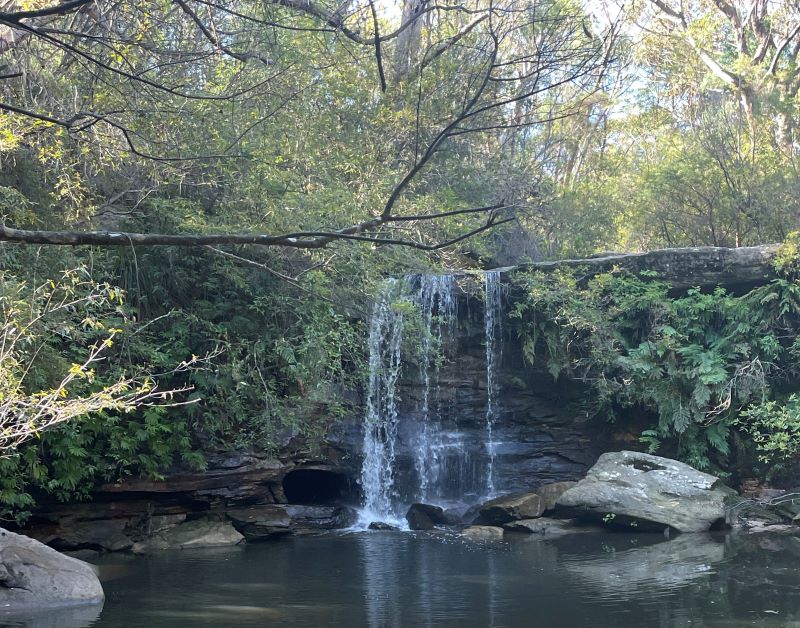
Manly Dam is an extensive, tranquil bushland valley containing Sydney's largest freshwater lake created by the damming of Curl Curl Creek in 1892. The Circuit Walk includes the Gulgadya Mura Aboriginal Walk and there are information boards on the axe grinding grooves, Aboriginal carvings, and rock paintings in the area. The walk has wildflowers, waterfalls, rock pools, birdwatching, frog spotting and several beautiful rock ledge viewpoints.
The walk starts at Manly-Warringah War Memorial Park at the dam wall and heads north along the western side of the dam above the main picnic areas before passing through an artificial wetland supporting Black Swans and Native Swamphens. Push on north past a waterfall to the crossing of Curl Curl Creek at an intersection at the northern end of the dam lake. Follow the track east and then south above the lake to cross Cootamundra Drive Creek and then the dam wall to return to your start at War Memorial Park.
Public Transport
T1 or T8 train from Central Station to Wynyard Station and 172X bus from stand A in Carrington Street to stop 209357 in Daisy Street opp. Woodbine Street, Nth Balgowlah. The start of the walk is 500 metres north along Water Reserve Road and a bush track to War Memorial Park. Return by same bus on the opposite side of Daisy Street and same train. A trip planner is available from Transport NSW web site.