

Distance
10.0 kilometres one way
Duration
4hrs 15mins
Suitable for
Walking / Jogging
Trail Grade
Grade 2
Terrain
Flat
Park(s)
Mackey Park, Steel Park, Beaman Park, Ewen Park, Close St. Reserve, Lees Park, Croydon Park, Rosedale Reserve, Flockhart Park, Brown Reserve, Whiddon Reserve, Walsh Avenue Reserve
Area
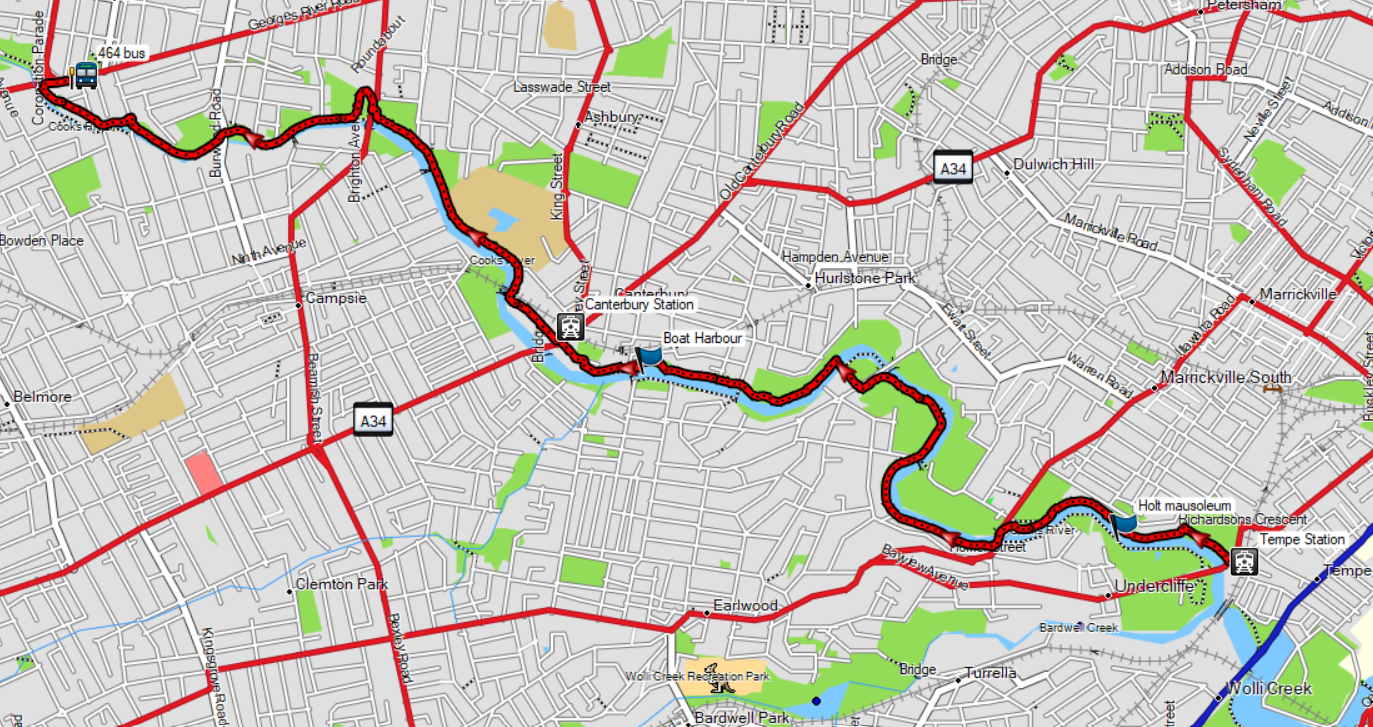
Cooks River

Travel Options
Train/Bus, Car (Tempe Station carpark; Walsh Avenue, Croydon Park)
Travel Time from Central Sydney
¼ hour (by car)
Map

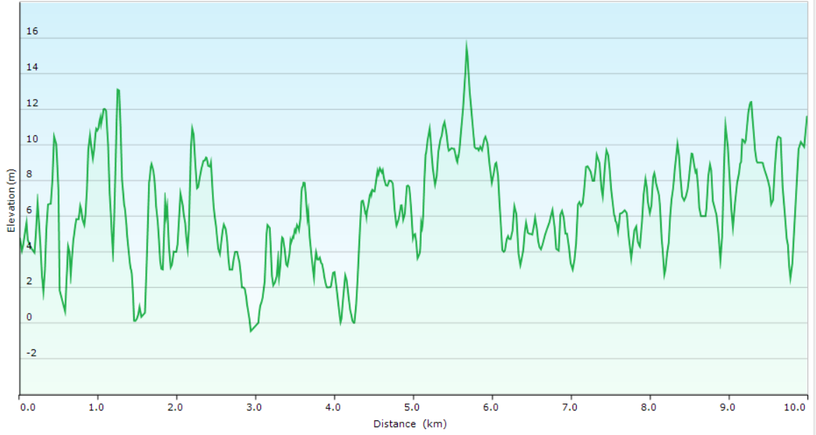
Ascent/Descent
About the Walking Track
At Tempe Station cross Richardsons Crescent into Mackey Park and head north-west along the northern bank of Cooks River to Illawarra Road where you switch to the southern bank footpath to Canterbury Rugby Club. Re-cross the river and follow the northern bank footpath to Georges River Road.
You will be stunned at the transformation of Cooks River. Festering mounds of garbage have been replaced by green playing fields fringed by whispering She-oaks. Factories pouring pollution it have been transformed into upmarket apartments. Rubbish-strewn, eroded banks have been replaced by rapidly re-colonising mangroves. Cooks River Alliance between local council and environment groups has worked a miracle that you will thoroughly enjoy.
Public Transport
Train from Central Station to Tempe Station. Return by 464 bus to Burwood Station and T9 train to Central Station. A trip planner is available from Transport NSW web site.