
Distance
8.3 kilometres circuit
Duration
3hrs excluding breaks
Suitable for
Walking/ Jogging
Trail Grade
Grade 2
Terrain
Hilly
Park(s)
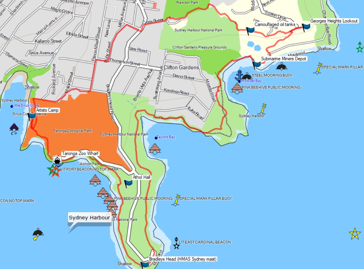
Sydney Harbour National Park, Clifton Gardens Reserve, Headland Park, Bradley Bushland Reserve, Rawson Oval, Little Ashton Park, Sirius Cove Reserve
Area
North Shore

Travel Options
1. Ferry2. Car (Athol Wharf Road)

Travel Time from Central Sydney
20-40 mins (by car)
Map

Ascent/Descent
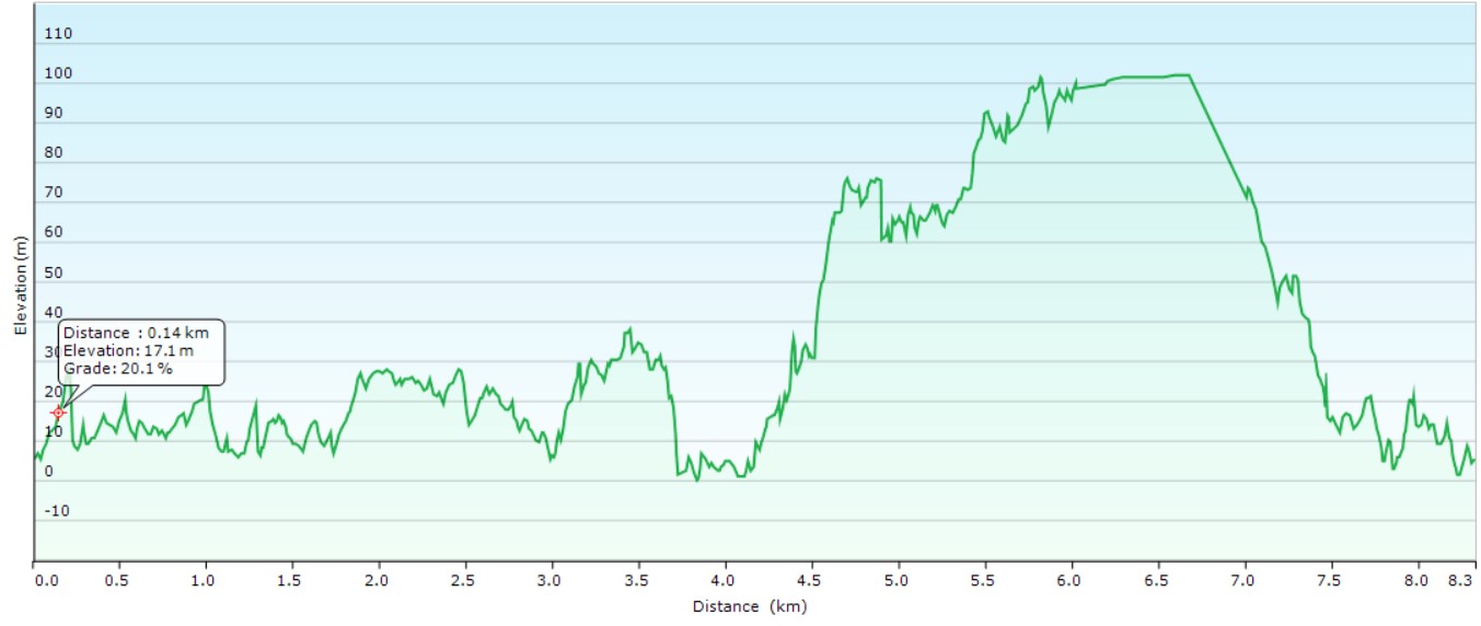
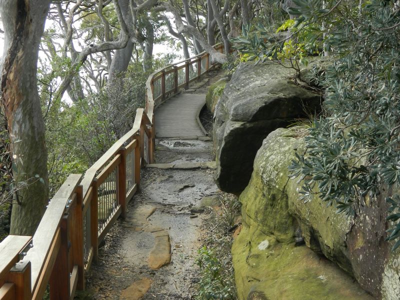
About the Walking Track
Head east from the Taronga Zoo Wharf to the Bradleys Head Track opposite the Zoo entrance. Follow this track past the harbour views and amphitheatre to Bradleys Head and the mast of HMAS Sydney. Continue along Taylors Bay and round Chowder Head through bushland to Chowder Bay via Clifton Gardens Reserve. Walk up the steps behind green weatherboard building to Georges Heights. Enjoy the harbour views over the 1870's fortifications at Georges Head Lookout designed by Richard LePlastrier. Peer over the western edge above the Gunners Barracks, Chowder Bay and Chowder Head to the city skyline. Return to a path at the bend in the driveway to the Gunners Barracks and through the bush to the Camouflaged Fuel Tanks, Headland Park and Rawson Park. Great views from the top of the mounds. Head south-west along leafy streets towards the steps down to Sirius Cove and follow the harbour-side track past the Artists’ camp to Taronga Zoo Wharf.
Public Transport
T2 train from Central to Circular Quay Station and F2 ferry from wharf 4B to Taronga Zoo Wharf. Return by same ferry and train to central. A trip planner is available from Transport NSW web site. (https://transportnsw.info/trip)