The Great West Walk
The Great West Walk
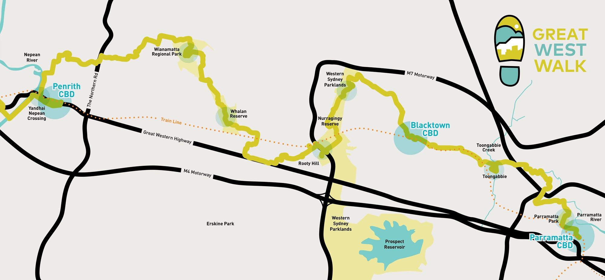
This magnificent 150km walking track stretches from Parramatta Park to the foot of the Blue Mountains and on to Katoomba. The Walk winds through significant public parklands following wherever possible rivers such as the Parramatta and Nepean and creeks that include Toongabbie, Breakfast, Eastern and Ropes Creek before winding up the foothills to the rugged sandstone escarpments of the Blue Mountains.
The Great West Walk was mapped by an experienced group called The Walking Volunteers and is strongly supported by relevant State Government Departments and agencies, and local Councils.
The Walk was opened on 11 October 2019 and is now part of the ‘Sydney Walking Tracks’ network that extends along Sydney’s coast from Broken Bay to Royal National Park, around the foreshores of Sydney Harbour to Parramatta, on to the Nepean River and Blue Mountains and around the Hills District and Southern Sydney.
MAP: The Great West Walk map prepared by The Walking Volunteers. The main track route is in red, with many secondary routes in green. The walks are all interconnected with sections able to be walked in hours, half day or days of one’s own choosing.
TRACK NOTES: An Information Kit prepared by The Walking Volunteers
WEBSITES: Western Sydney Regional Organisation of Councils (WSROC) has a specific website greatwestwalk.com.au. See also: Western Sydney Parklands Trust; City of Parramatta; Blacktown Council; Bushwalking NSW.
In The News
The Great West Walk gained considerable media coverage.
Sydney Morning Herald NSW Government Channel 9 News Blacktown council release Concrete playground Timeout Great Walks Urban List Architecture & Design We Are Explorers Australia Geographic Mirage News The National Tribune Broadsheet
Video
Western Sydney has a new draw card of its own – The “Great West Walk”, which stretches 65 kilometres from Parramatta to the Blue Mountains.
#9News | http://9News.com.au
Posted by 9 News Sydney on Tuesday, October 15, 2019
Gallery
Walk Highlights
- Bicentennial Square, Parramatta
- Eat Street (Church Street), Parramatta
- Brislington House, Parramatta
- Old Government House, Parramatta Park
- Old Observatory, Parramatta Park
- The Old Dairy, Parramatta Park
- Wisteria Garden and Glengariff House, Westmead
- Toongabbie Creek, Winston Hills
- The Lost Rogans Hill Railway Line, Northmead
- Third Settlement Reserve, Winston Hills
- International Peace Park, Seven Hills
- Blacktown Showground, Blacktown
- Nurragingy Reserve, Western Sydney Parklands
- Chang Lai Yuan Chinese Gardens, Western Sydney Parklands
- Blacktown International Sports Park, Western Sydney Parklands
- Rooty Hill Historic Site, Rooty Hill
- Neoblie Historic Cottage, Rooty Hill
- Federation Forest, Mount Druitt
- Ropes Crossing Station Reserve, Ropes Crossing
- Wianamatta Regional Park
- The Nepean River, Penrith


