


Terrain
Hilly
Park(s)
Western Sydney Parklands
Area
Liverpool District

Travel Options
Train/Bus), Car (Lizard Log carpark)
Travel Time from Central Sydney
¾ - 1 hour (by car)
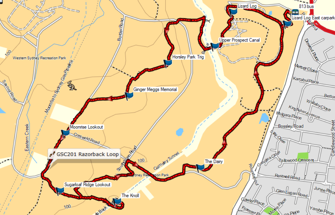
Map

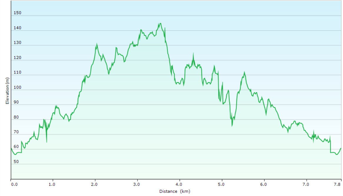
Ascent/Descent
About the Walking Track
Follow the path from Lizard Log to Upper Prospect Canal and then a path and track up the Devils Back Ridge to Moonrise Lookout. Along Boundary Road to Razorback Lookouts and the Knoll. Re-trace your steps to the second Razorback Lookout and follow steps and a track to Cotswold Road and a path to The Dairy back to Lizard Log.
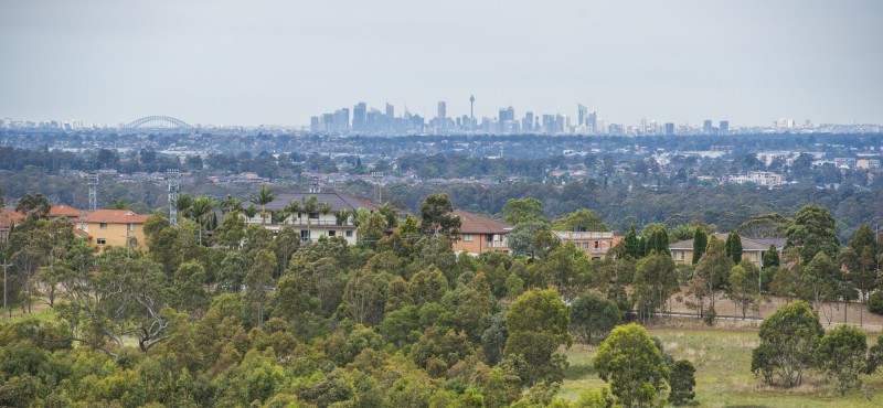
The wide slashed paths of Western Sydney Parklands are a delight to walk on while the gargantuan tree-planting program provides welcome shade at Lizard Log and Devils Back Ridge. The Upper Prospect Canal is a tribute to the skills of the engineers who built it in 1888 while Ginger Meggs Memorial is a moving homage to a faithful canine friend. Moonrise Lookout, the Razorback Lookouts and The Knoll provide excellent views from the scar of Lucas Heights to the towers of Sydney’s CBD.
Public Transport
T2 train from Central Station to Fairfield Station and 813 bus from Fairfield Station to Lizard Log in Western Sydney Parklands. A trip planner is available from Transport NSW web site.